The Future of Exploration: How Google is Blending Reality with Android XR
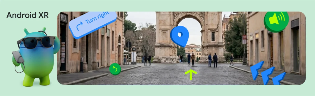
In a significant leap for spatial computing, Google has officially unveiled the preview of its Geospatial API for ARCore within the Jetpack XR SDK. Announced at this year’s Google I/O, this development marks a pivotal shift in how mobile developers can anchor digital content to the physical world. By integrating Google’s Visual Positioning System (VPS) into the Android XR ecosystem, the company is enabling a new generation of "world-scale" augmented reality experiences that boast sub-meter accuracy and precise orientation.
To demonstrate the transformative potential of this technology, Google’s internal team developed the "XR Geospatial Tour"—a hands-free, AI-powered walking tour that serves as a blueprint for the future of urban exploration.
The Core Innovation: Merging VPS with Spatial Computing
At the heart of this technological advancement is the fusion of Global Positioning System (GPS) data with the Visual Positioning System (VPS). While standard GPS is effective for general navigation, it often falls short in the dense urban environments where XR is most useful. GPS can struggle with signal reflection off skyscrapers—a phenomenon known as "urban canyons"—leading to location errors of several meters.
Google’s VPS solves this by using advanced computer vision to compare the user’s camera view against Google’s vast database of imagery. By matching visual landmarks in real-time, the Geospatial API provides a GeospatialPose (including latitude, longitude, and heading) with a level of precision that GPS alone cannot achieve. This allows developers to anchor 3D objects, navigational waypoints, and informational nodes to the physical world with remarkable stability.
Chronology of the Development
- Google I/O Announcement: Google formally introduced the integration of the Geospatial API into ARCore for Jetpack XR, signaling a move toward cross-platform spatial consistency.
- The Prototyping Phase: The engineering team began synthesizing Gemini API, Google Maps Grounding, and Jetpack XR to build the "XR Geospatial Tour."
- The Developer Catalyst Launch: Concurrent with the API release, Google opened applications for the Android XR Developer Catalyst Program, providing select developers with hardware like the XREAL Project Aura.
Orchestrating the Experience: The Synergy of APIs
The "XR Geospatial Tour" is not merely a technical showcase; it is a complex orchestration of multiple Google-led technologies. The workflow involves four primary stages, each critical to creating a fluid, immersive experience.
1. High-Precision Localization
The foundation of the experience relies on the ARCore Geospatial API. Before the tour begins, the system monitors horizontalAccuracy and orientationYawAccuracy. If the user is indoors or in an area where the VPS signal is insufficient, the system proactively prompts the user to move to a more recognizable outdoor public space. Once the confidence thresholds are met, the device locks onto the user’s precise coordinate, ensuring that the 3D content remains "pinned" to the environment.
2. Intelligent Itinerary Generation
Once the user’s location is established, the application queries the Gemini API via Firebase AI Logic. The system is programmed to act as a local, knowledgeable tour guide. By passing the user’s coordinates, the model generates structured JSON responses containing curated walking tours.
Crucially, Google has addressed the issue of AI "hallucinations"—where models might invent non-existent locations—by implementing Google Maps Grounding. This ensures that every recommendation is backed by real-world geographic data, maintaining the integrity of the tour.
3. Natural Language and Dynamic Voice
A key element of immersion is the "presence" of the guide. Instead of forcing the user to read text on a screen, the team utilized the Gemini 2.5 flash-tts model. By setting the ResponseModality to AUDIO, the system returns raw audio bytes, allowing for a neutral, positive, and conversational voice that explains historical landmarks in real-time.
4. 3D Visualization via Jetpack XR
The final layer is the rendering. Using Compose for XR, developers can transition from traditional 2D UI to spatial computing components. The tour uses SpatialBox and SceneCoreEntity to place 3D "InfoSpheres" along the path. These spheres act as interactive anchors that, when tapped, reveal deep-dive information about the surroundings, blending the digital and physical worlds into a single, cohesive experience.
Implications for Developers and the XR Industry
The implications of these tools are far-reaching. By lowering the barrier to entry for spatial development, Google is encouraging a shift away from 2D, screen-bound interfaces toward environments where information is embedded in the world itself.
Impact on Urban Navigation
Traditional 2D maps require cognitive effort to translate a top-down view into a forward-facing reality. The XR Geospatial Tour removes this cognitive load. By placing 3D pathfinding models in the user’s direct line of sight and providing audio cues based on the user’s current orientation, the technology makes navigation feel intuitive rather than academic.
The Rise of the "Spatial Web"
The integration of Gemini with spatial APIs suggests a future where the internet is not just a collection of pages, but a layer of data overlaid on reality. As wearable hardware becomes more sophisticated—such as the upcoming XREAL Project Aura—the ability for developers to build apps that "understand" the physical world will become a competitive necessity.
Developer Accessibility
Google’s strategy of providing a unified SDK (Jetpack XR) is designed to ensure that Android developers do not need to learn entirely new paradigms to enter the spatial market. If a developer is already comfortable with Jetpack Compose, the transition to building 3D, spatially-aware interfaces is significantly streamlined.
Official Perspective and Future Outlook
In their commentary, Google’s engineering team emphasized that the "XR Geospatial Tour" is a demonstration of what is possible, but it also serves as a rallying cry for the developer community. The Android XR Developer Catalyst Program is the next phase of this strategy. By putting hardware like the XREAL Project Aura into the hands of creators, Google hopes to foster an ecosystem where the next "killer app" for AR can emerge.
"Building the XR Geospatial Tour app showed us that the barrier to entry for world-scale spatial experiences is lower than ever," the team noted in their official release. "By combining Compose for XR’s APIs with the high-precision location data of VPS and the generative capabilities of Gemini, we can create experiences that understand both where the user is and what they are looking at."
The Road Ahead
While the current implementation is a preview, the trajectory is clear: Google is moving toward a standard where the physical world serves as the primary interface for digital information. As the hardware matures and the Geospatial API reaches general availability, we can expect to see a surge in applications that turn every city street into an interactive museum, a guided shopping center, or an immersive game board.
For developers, the call to action is immediate. The tools for creating the next generation of spatial experiences are now available, and the combination of generative AI with precise location tracking is likely to define the next decade of mobile technology. As Google continues to refine these APIs, the line between "looking at a map" and "experiencing the world" will continue to blur, setting the stage for a truly augmented reality.
Disclaimer: The demo and the XR Geospatial Tour application are provided for demonstration purposes only. Sequences have been shortened for clarity. Hardware mentioned, including the XREAL Project Aura, is currently under development; final product specifications and features may vary upon release.