The Future of Navigation: How Android XR and Google’s Geospatial API are Redefining Spatial Reality
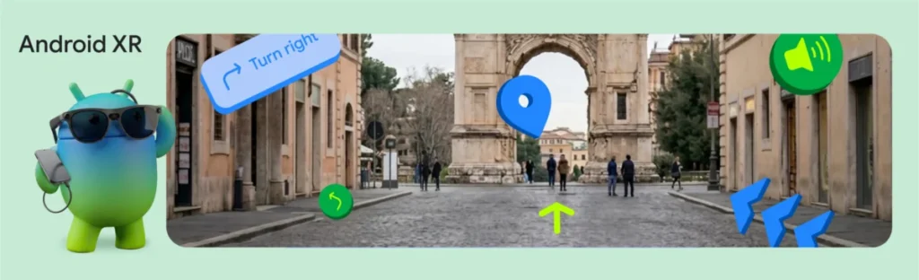
The landscape of personal navigation is undergoing a tectonic shift. For over a decade, we have relied on the flat, two-dimensional constraints of smartphone screens to guide us through physical environments. We look down at blue dots on a map, squinting to orient ourselves against the horizon. But at this year’s Google I/O, the tech giant unveiled a vision for a future where that barrier is dissolved entirely: the integration of the Geospatial API into ARCore for Jetpack XR.
By bringing Google’s Visual Positioning System (VPS) into the realm of Extended Reality (XR), Google is enabling developers to anchor digital content to the physical world with sub-meter accuracy. This isn’t just an incremental update; it is a fundamental reimagining of how humans interact with their environment.
The Convergence of Precision and Perception
The core challenge of spatial computing has always been the "anchor." How does a device know exactly where it is in the world, not just relative to a GPS satellite, but relative to the specific storefront or statue standing in front of it?
The answer lies in the Geospatial API. By leveraging Google’s massive, proprietary database of street-level imagery and point-cloud data, the VPS allows Android XR devices to cross-reference the user’s camera feed with known world data. The result is a GeospatialPose—a highly accurate coordinate set including latitude, longitude, and heading—that far surpasses the capabilities of standard GPS, which can often struggle with "urban canyons" created by tall buildings.
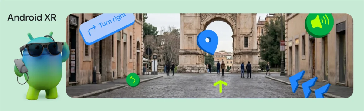
In the newly announced "XR Geospatial Tour" demo, Google demonstrates the implications of this tech. Imagine walking through the streets of a historic city while wearing lightweight XR glasses, such as the upcoming XREAL Project Aura. Instead of a map, a virtual guide manifests in your peripheral vision, pointing out landmarks and narrating their history in real-time, all while you keep your hands free and your eyes on the environment.
Chronology of Development: From Mapping to Immersive Reality
To understand how we arrived at this moment, one must look at the evolution of Google’s spatial stack:
- Foundational Mapping (2005–2015): The era of Google Maps, which provided the backbone for global location data.
- The ARCore Inflection (2017): Google introduced ARCore, bringing motion tracking and light estimation to mobile devices, allowing developers to place virtual objects on flat surfaces.
- The Advent of VPS (2020–2022): Google unlocked the Geospatial API for mobile, allowing AR experiences to be pinned to specific geographic coordinates.
- The XR Integration (2024–Present): The introduction of ARCore for Jetpack XR. This is the current frontier, where spatial awareness is no longer confined to a smartphone screen but is projected directly into the wearer’s field of vision via XR hardware.
This progression marks the transition from "looking at the world through a window" to "overlaying information onto the world itself."
The Architecture of an Immersive Tour
The XR Geospatial Tour is not merely a gimmick; it is a masterclass in modern software architecture. It stitches together four distinct Google technologies to create a seamless, hands-free experience.
1. The Spatial Foundation
The process begins with the GeospatialPose. By monitoring horizontalAccuracy and orientationYawAccuracy, the application ensures that the virtual environment is perfectly aligned with physical reality. If the device detects that the user is indoors or in an area with insufficient visual data, it intelligently prompts the user to move to an open area, ensuring the "anchor" is stable before the tour begins.
2. Intelligent Itineraries via Gemini
Once the location is locked, the application calls upon the Gemini API, utilizing Firebase AI Logic. By grounding the model with Google Maps data, developers can request structured, location-aware itineraries. A query like, "Generate a three-stop historical walking tour in this neighborhood," returns a JSON object containing specific, verified waypoints. This eliminates the "hallucination" risk inherent in generative AI, ensuring the tour is physically walkable and historically accurate.
3. Native Voice Synthesis
The "tour guide" persona is brought to life using the gemini-2.5-flash-tts model. Unlike traditional text-to-speech engines that sound robotic, this model can be instructed to return audio data natively. By setting the ResponseModality to AUDIO, the application streams natural, expressive voiceovers directly to the user’s ears, creating an emotional connection between the digital guide and the explorer.
4. The Jetpack XR UI Layer
Finally, the visual representation of the tour is rendered using Jetpack Compose for XR. Developers use SpatialBox and SceneCoreEntity to place 3D "InfoSpheres" at specific coordinates. These aren’t just static images; they are interactive entities that respond to user input, such as a gaze or a tap, allowing the user to dive deeper into the history of a building or the menu of a nearby restaurant.
Supporting Data: The Technical Edge
The accuracy of this system is its most compelling feature. While consumer-grade GPS typically provides an accuracy range of 5 to 10 meters—often problematic in dense urban environments—the integration of VPS brings this down to sub-meter levels.
Furthermore, the integration of InteractableComponent within the Jetpack XR SDK allows for a low-latency response to user interaction. When a user interacts with a 3D orb, the inputEvent is processed in milliseconds, maintaining the "spatial illusion." Without this, the psychological immersion—the feeling that the digital object truly exists in the physical space—would be shattered by "floaty" or unresponsive UI elements.
Official Perspectives: A Catalyst for Change
"The goal," notes the Google XR engineering team, "is to lower the barrier to entry for world-scale spatial experiences."
By abstracting the complexities of 3D spatial mapping and generative AI, Google is positioning the Android XR platform as the standard for future wearable computing. The move is a clear signal to the developer community: the tools are ready. The "Android XR Developer Catalyst Program" is the next phase of this strategy, providing hardware access to developers to ensure that when the consumer market for XR glasses matures, a robust ecosystem of applications is already waiting.
The Broader Implications
The shift toward Geospatial-aware XR has profound implications for several industries:
- Tourism: Traditional tour groups may be replaced by personalized, on-demand AI guides that can pivot based on the user’s pace and interests.
- Accessibility: For those with visual impairments or mobility challenges, real-time spatial guidance can offer a level of independence previously unattainable, with AI narrating obstacles and providing safe, accessible routes.
- Retail and Commerce: "Local discovery" will no longer be limited to a mobile search. A user could look at a storefront and see an interactive, 3D preview of the products inside, grounded directly on the shop’s physical door.
Conclusion: The Horizon of Spatial Computing
As we look toward the wider adoption of XR hardware, the technical implementation of the Geospatial API serves as a blueprint for the future of human-computer interaction. We are moving away from an era where technology is a distraction—something that pulls us out of the real world—and into an era where technology serves as a lens, enhancing our understanding of our surroundings.
With the combination of VPS, generative AI, and the Jetpack XR SDK, Google has effectively turned the entire physical world into an interactive interface. The XR Geospatial Tour is merely the first chapter. As developers begin to iterate on these tools, we can expect to see a new generation of applications that don’t just show us the world, but help us experience it with a depth and clarity that was once the domain of science fiction.
The barrier to building these worlds has never been lower. For those ready to step into the spatial era, the tools are now in your hands.