The Future of Navigation: How Google’s ARCore and Gemini are Redefining Spatial Computing
In the rapidly evolving landscape of spatial computing, the gap between the digital and physical worlds is closing faster than ever. At this year’s Google I/O, the tech giant unveiled a transformative update to its ARCore ecosystem: the Geospatial API is now available as a preview in ARCore for Jetpack XR. This integration marks a pivotal shift, enabling developers to anchor high-fidelity digital content to the physical world with sub-meter accuracy. By leveraging Google’s Visual Positioning System (VPS) within the Android XR framework, the company is not merely updating an API; it is laying the groundwork for a new era of augmented reality where the entire globe becomes a canvas.
The Convergence of Vision and Reality
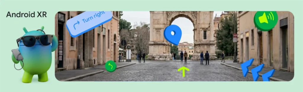
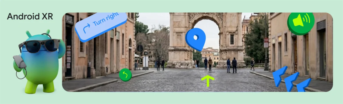
To demonstrate the potential of this technology, Google’s engineering team developed the "XR Geospatial Tour"—a hands-free, AI-driven walking tour experience. Imagine traversing an unfamiliar city, equipped with lightweight, wired XR glasses such as the forthcoming XREAL Project Aura. Instead of glancing down at a 2D map on a smartphone, you are guided by intuitive 3D waypoints that manifest in your peripheral vision, while an intelligent, synthetic voice narrates the history of the landmarks you pass.
This experience is not the result of a single breakthrough but a sophisticated orchestration of four core technologies: the Geospatial API, the Gemini API (powered by Firebase AI Logic), Google Maps Grounding, and the Jetpack XR SDK. Together, these tools allow for a persistent, context-aware experience that understands exactly where a user is, what they are viewing, and how to narrate that environment in real time.
Chronology of Development: A New Toolkit for Spatial Builders
The trajectory toward this immersive reality began with the maturation of ARCore, Google’s platform for building augmented reality experiences. Initially focused on mobile devices, the evolution of ARCore into the Android XR space represents a strategic pivot toward wearable interfaces.
1. Pinpointing Presence with VPS
The foundation of any spatial experience is accurate localization. While standard GPS is sufficient for general navigation, it lacks the vertical and orientation precision required for seamless AR. By integrating the Geospatial API, developers can access a GeospatialPose, which includes latitude, longitude, and heading data derived from advanced computer vision.
The process involves a continuous handshake between the device’s sensors and Google’s vast VPS database. Developers monitor horizontal and orientation accuracy thresholds, ensuring that if a user moves into a "blind spot" or indoors, the application can intelligently prompt them to re-orient themselves in an outdoor public space.
2. Orchestrating the Experience with Gemini
Once the device establishes a precise location, the system initiates a conversation with the Gemini API. By utilizing Firebase AI Logic, the application prompts Gemini to act as a local expert. The model receives the user’s current coordinates and outputs a structured JSON response, effectively "grounding" the AI’s creative narrative in factual data.
This grounding is critical. Large Language Models are known for their tendency to hallucinate; by utilizing Google Maps Grounding, developers ensure that the suggested tour stops, historical facts, and pathing recommendations are tethered to verified geographic data.
3. Voice and Presence
To achieve a human-like tour guide, Google implemented the Gemini 2.5 flash-tts model. Unlike traditional text-to-speech engines, this model natively returns audio data, allowing for nuanced, emotionally resonant voiceovers that can be configured via ResponseModality.AUDIO.
4. Rendering in the Third Dimension
The final hurdle is the visualization of this data. With the Jetpack XR SDK and Compose for XR, developers can transition from traditional 2D UI paradigms to spatial interfaces. By employing SpatialBox and SceneCoreEntity, developers can place 3D assets—like interactive "InfoSpheres"—directly into the user’s field of view. These entities respond to user input via InteractableComponent, creating a fluid, tactile interaction model that feels natural in a 3D environment.
Supporting Data: The Power of Integration
The technical implementation of these features provides a blueprint for developers aiming to build world-scale applications. Consider the complexity of the Gemini model integration:
- The Schema: By defining a strict JSON schema for the AI’s output, developers ensure that the app receives structured data (title, description, and list of stops) rather than unstructured text. This makes the data immediately ready for UI binding.
- The Spatial Logic: The use of
AnimatedSpatialVisibilityallows for the seamless transition between 2D panels and 3D objects, ensuring the user experience isn’t interrupted by clunky interface shifts. - The Hardware: The partnership with XREAL for the Project Aura glasses provides the necessary hardware form factor—lightweight, wearable, and capable of high-fidelity rendering—to make these software advancements usable in everyday life.
Official Perspectives and The Developer Catalyst Program
The release of the Geospatial API for Android XR is not just a feature update; it is an invitation to the global developer community. Google has launched the "Android XR Developer Catalyst Program" to foster innovation in this space. This initiative provides select developers with early access to the XREAL Project Aura devkit, effectively removing the hardware barrier that has historically hindered AR development.
"Building the XR Geospatial Tour app showed us that the barrier to entry for world-scale spatial experiences is lower than ever for Android developers," said a Google spokesperson. "By combining Compose for XR’s APIs with the high-precision location data of VPS and the generative capabilities of Gemini, we can create experiences that understand both where the user is and what they are looking at."
Implications for the Future of Tech
The implications of this technology extend far beyond tourism. The ability to anchor persistent, accurate digital information to specific geographic locations has profound consequences for several industries:
- Urban Planning and Navigation: City planners could use these tools to visualize proposed infrastructure changes for citizens, allowing them to "see" a new building or park before it is constructed.
- Education: Field trips could be transformed by overlaying historical context onto modern city streets, allowing students to witness historical events exactly where they occurred.
- Accessibility: For those with visual impairments, a system that provides constant, high-accuracy spatial awareness and audio narration could be a life-changing tool for independent navigation.
- Retail and Commerce: Retailers could implement "spatial shopping," where physical items are tagged with digital information, reviews, and availability as customers walk through a store.
However, the technology also invites a necessary discussion regarding privacy and the "digital twin" of our physical world. As we populate our public spaces with digital information, questions regarding data ownership, the moderation of AR content, and the rights of property owners will undoubtedly become central to the policy conversation.
Conclusion
Google’s latest update to ARCore for Jetpack XR represents a significant leap forward in making spatial computing accessible and practical. By lowering the barrier to entry for world-scale AR, Google is shifting the conversation from "what could we build?" to "what will we build first?"
As the Developer Catalyst Program begins to distribute hardware to creators, we are likely to see an explosion of experimental applications that blur the line between the physical and the digital. The future of navigation is no longer a blue dot on a flat screen; it is a rich, conversational, and deeply spatial experience that walks alongside us, one city block at a time. The tools are now in the hands of the developers—the map is ready, and the world is waiting.