Google Earth Desktop Client to Be Retired in 2027: A Digital Cartography Era Nears Its End
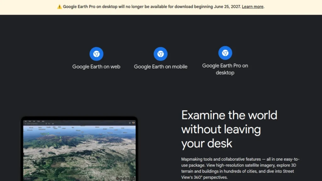
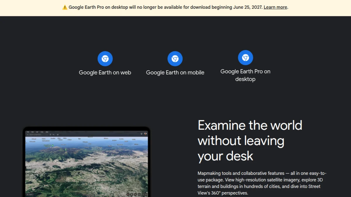
Mountain View, CA – July 16, 2026 – After two decades of enabling desktop-based virtual global exploration, Google has announced the impending discontinuation of its standalone Google Earth desktop client. Effective June 2027, the application will no longer be available for new downloads, signaling a definitive shift in the tech giant’s strategy towards browser-based and mobile platforms for its popular geospatial service. While existing installations will continue to function for an unspecified period, the move marks a significant transition for millions of users who have relied on the robust desktop version for everything from casual browsing to advanced geographical analysis.
The announcement, delivered through a post on Google Earth’s official support community by Community Manager Aamir F., clarifies that the June 2027 cutoff date specifically pertains to new downloads. Critically, the backend infrastructure supporting Google Earth is not immediately changing, suggesting that users who already have the client installed will be able to continue using it. However, the absence of future updates and the inherent risks of relying on unsupported software raise significant questions about the long-term viability and security of these legacy installations. This decision underscores a broader industry trend where dedicated desktop applications are increasingly giving way to more accessible and continuously updated web and mobile counterparts.
Main Facts
The End of an Era for Google Earth Desktop
The news that Google Earth’s desktop client will cease new downloads in June 2027 reverberates across the communities of educators, researchers, hobbyists, and professionals who have long utilized its unique capabilities. Launched in 2005, Google Earth revolutionized how individuals interacted with geographical data, offering an unprecedented level of virtual immersion into the planet’s landscapes. For nearly two decades, the desktop application stood as the most comprehensive and feature-rich iteration of the service, allowing users to zoom from space to street level, explore 3D terrain, overlay custom data, and even conduct virtual flights. Its discontinuation represents not just a product change but a symbolic end to a particular mode of digital exploration that prioritized deep functionality on a local machine.
Google’s strategic pivot is clear: the future of Google Earth, much like many of its other services, lies firmly within the ecosystem of web browsers and mobile devices. This alignment allows for greater accessibility, seamless updates, and a more unified user experience across diverse platforms, reducing the complexities and costs associated with maintaining a dedicated desktop client. While the web and mobile versions have made significant strides in mirroring the desktop experience, many power users argue that they still fall short in replicating the full breadth of features and the nuanced control offered by the original application. The transition will undoubtedly challenge long-established workflows and force many to adapt to new interfaces and potentially different toolsets.
The Phased Sunset: What Users Need to Know
The "phased sunset" approach articulated by Google offers a temporary reprieve but also introduces an element of uncertainty. For existing users, the immediate comfort is knowing that their installations will continue to function post-June 2027. This means that maps can still be loaded, existing KML/KMZ files can be opened, and many core functionalities will remain accessible. However, this continued operation comes with a critical caveat: Google will no longer provide updates for the desktop client. This lack of ongoing development implies several significant risks and limitations.
Firstly, security patches will cease. As operating systems evolve and new vulnerabilities are discovered, an unpatched Google Earth desktop client could become a potential entry point for malicious actors, especially if it relies on outdated components or communicates with insecure servers. Secondly, compatibility with future operating system updates cannot be guaranteed. A major OS-level change could render the application unstable or entirely non-functional without Google issuing a necessary patch. Thirdly, any breaking changes on Google’s API side, or alterations to how the Earth data is served, could eventually cripple the client, as it will no longer receive updates to adapt. Therefore, while the lights aren’t going out immediately, the road ahead for the desktop client is one of gradual decay, its lifespan dictated by external factors beyond user control. The implication is clear: users should not expect the desktop client to remain a reliable tool indefinitely, and proactive planning for migration to alternative solutions is advisable.
Chronology
A Legacy of Exploration: Google Earth’s Journey
The story of Google Earth begins not with Google, but with a company called Keyhole Inc., founded in 1999. Keyhole developed a groundbreaking geospatial software application known as EarthViewer 3D, which allowed users to fly over a virtual representation of the Earth using satellite imagery and aerial photography. Its innovative streaming technology and intuitive 3D interface quickly garnered attention, particularly from the intelligence community and media outlets. Google, recognizing the immense potential of this technology, acquired Keyhole Inc. in October 2004. This acquisition was a pivotal moment, laying the groundwork for what would become one of the most iconic applications of the internet era.
In June 2005, Google officially launched Google Earth to the public, offering free and paid (Pro) versions. The immediate impact was profound. For the first time, ordinary individuals could virtually explore nearly any corner of the planet from their personal computers, fostering a new era of geographical literacy and digital exploration. Over the years, Google Earth evolved rapidly, integrating an array of features that further cemented its status as a must-have application. Milestones included the introduction of Street View in 2007, allowing users to descend to ground level and explore cities as if walking through them. The addition of 3D buildings, historical imagery allowing users to see how places changed over time, ocean exploration, Mars and Moon modes, and advanced measurement tools all contributed to a robust and ever-expanding platform. Educators used it for virtual field trips, scientists for environmental monitoring, architects for site planning, and millions of others for pure curiosity and discovery. Its intuitive interface and vast datasets made complex geographical information accessible to everyone, fundamentally changing how we perceive and interact with our world.
The Shift Towards Web and Mobile
While the desktop client was the flagship for many years, the technological landscape began to shift dramatically with the advent and widespread adoption of smartphones and high-speed mobile internet. The early 2010s saw a massive migration of internet users from desktop computers to mobile devices. Recognizing this trend, Google began investing heavily in mobile and browser-based versions of its services. Google Earth was no exception.
The first mobile versions of Google Earth were introduced, albeit with limited functionality compared to the desktop client. However, as mobile hardware became more powerful and web technologies like WebGL matured, the capabilities of browser-based and mobile applications rapidly expanded. Google Earth for Web, which leverages WebGL to render 3D environments directly in a browser, offered a compelling alternative to the desktop client. It removed the need for installation, made the service instantly accessible across different operating systems without specific client builds, and allowed for easier integration with other Google services and web applications.
The benefits of this shift were manifold:
- Accessibility: Users could access Google Earth from any device with a compatible browser or through dedicated mobile apps, regardless of their operating system.
- Maintenance: Developing and maintaining a single web application and mobile apps is significantly less resource-intensive than supporting multiple native desktop clients across various operating systems (Windows, macOS, Linux).
- Updates: Web and mobile applications can be updated seamlessly and frequently, ensuring users always have the latest features and security patches without manual downloads or installations.
- Integration: Browser-based Earth can integrate more smoothly with cloud services, user accounts, and other web-based tools, fostering a more connected experience.
This gradual but undeniable shift in technology and user behavior made the desktop client, with its specific installation requirements and maintenance overhead, increasingly an outlier in Google’s product portfolio. The decision to discontinue it reflects this broader industry trend towards ubiquitous, cloud-connected, and platform-agnostic service delivery.
Supporting Data and Industry Trends
User Behavior and Platform Preferences
The decision to sunset the Google Earth desktop client is not an isolated event but rather a reflection of pervasive trends in user behavior and platform preferences across the digital landscape. Over the past decade, there has been a significant and sustained migration of internet users from desktop-centric computing to mobile devices and web browsers. According to numerous industry reports, mobile devices now account for the majority of global internet traffic, surpassing desktop usage. Users increasingly value convenience, instant access, and the ability to switch seamlessly between devices without the need for dedicated software installations.
For many services, the "appification" of the internet has meant that users are more likely to interact with a brand or service through a mobile application or a responsive website than through a legacy desktop program. This shift is driven by several factors:
- Ubiquity: Smartphones are almost always with us, making mobile apps the most immediate access point for information and services.
- Zero-installation convenience: Browser-based services eliminate the friction of downloading, installing, and updating software, offering instant access.
- Cloud synchronization: Web and mobile platforms inherently leverage cloud storage and synchronization, ensuring data and preferences are consistent across all devices.
- Ecosystem integration: Mobile and web versions often integrate more naturally with other cloud services and social platforms.
While the Google Earth desktop client offered a powerful, self-contained experience, it required a conscious decision to download and install, and then periodic manual updates or system checks. For the vast majority of casual users, this friction became increasingly less appealing compared to simply opening a browser tab or launching a mobile app. Google’s internal data, though not publicly disclosed in detail, undoubtedly reflects this broader trend, showing a declining proportion of active users engaging with the desktop client compared to its web and mobile counterparts. The economics of maintaining a separate, increasingly niche platform simply no longer align with the company’s strategic priorities.
The Economics of Software Maintenance
From a corporate perspective, the decision to discontinue the Google Earth desktop client is largely an economic one, rooted in the significant costs associated with developing, maintaining, and updating software across multiple platforms. Creating and sustaining a native desktop application is a complex and resource-intensive endeavor that goes far beyond initial development.
Key cost factors include:
- Cross-platform development: Ensuring compatibility and feature parity across different operating systems (Windows, macOS, potentially Linux) requires separate development teams, distinct codebases, and continuous testing. Each OS update or major release can introduce compatibility issues that demand immediate attention and resource allocation.
- Security maintenance: Desktop clients are susceptible to operating system-specific vulnerabilities and require ongoing security patches. This involves constant monitoring, rapid response to threats, and distribution of updates, which is a non-trivial task.
- Feature development and bug fixing: Releasing new features or fixing bugs often requires implementing changes across all supported platforms, multiplying development efforts.
- Technical support: Supporting a desktop client involves dealing with a wider array of hardware configurations, operating system versions, and potential conflicts with other installed software, leading to higher support costs.
- Infrastructure: While Google Earth data is cloud-based, the client itself requires a distribution mechanism, update servers, and potentially specific rendering pipelines that differ from web-based solutions.
By consolidating its efforts onto web and mobile platforms, Google can achieve substantial cost savings and reallocate engineering resources towards enhancing the user experience on its preferred platforms. This streamlined approach allows for faster iteration, more unified feature sets, and a more efficient use of development talent. The benefits for Google are clear: reduced overhead, accelerated innovation on core platforms, and a more consistent brand experience across its most widely used services.
Desktop-Exclusive Features: A Niche, Not a Mainstream
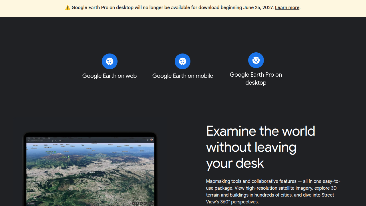
Despite the overwhelming shift towards web and mobile, the community thread discussing the discontinuation reveals a common lament: the loss of specific features unique to the desktop client. While the majority of Google Earth users may indeed be content with the capabilities offered by the web and mobile versions, a vocal minority of power users, researchers, and educators have long relied on the desktop client for advanced functionalities that are either absent or significantly curtailed in the browser and app iterations.
These desktop-exclusive features often include:
- Advanced GIS (Geographic Information System) Capabilities: The desktop client offered more robust tools for importing and exporting complex geospatial data formats (like shapefiles, KML/KMZ with advanced styling), performing precise measurements, and creating intricate overlays.
- Higher Resolution Printing and Export: Professionals often relied on the desktop client for generating high-resolution images or maps for reports, presentations, or academic papers, with greater control over resolution and print settings.
- Flight Simulator Mode: A popular feature for enthusiasts, the built-in flight simulator provided an immersive and interactive way to navigate the virtual globe, offering a level of control not replicated in other versions.
- Enhanced Tour Creation and Editing: The desktop client provided more granular control over creating and editing guided tours, including timing, camera angles, and annotations, making it a valuable tool for storytelling and educational content.
- Offline Caching and Performance: In some professional or remote settings, the ability to cache large areas for offline viewing or to leverage local system resources for smoother rendering was a significant advantage.
- Direct Access to Local Files: The desktop client allowed for seamless interaction with local files, making it easier to integrate Google Earth into existing desktop-based workflows and data analysis pipelines.
While these features are undeniably valuable to a specific segment of users, they likely represent a diminishing proportion of Google Earth’s overall user base. For Google, the cost-benefit analysis of maintaining these specialized functionalities for a niche audience, within the complex framework of a legacy desktop application, likely no longer justified the investment. The company’s focus has clearly shifted to optimizing the experience for the largest possible audience on its strategic platforms.
Official Responses and Community Reaction
Google’s Stated Position and Rationale
Google’s official communication regarding the desktop client’s retirement, primarily through Community Manager Aamir F.’s post, maintains a professional and somewhat understated tone. The core message focuses on the "cutoff date" for new downloads and the continued functionality of existing installs, aiming to mitigate immediate panic among current users. While the post doesn’t explicitly detail the rationale behind the decision, it implicitly aligns with Google’s broader strategy of platform consolidation and prioritization of web-first and mobile-first experiences.
The unstated rationale can be inferred from industry trends and Google’s corporate behavior:
- Focus on Innovation: By concentrating development resources on fewer platforms, Google can accelerate the pace of innovation and deploy new features more rapidly across its primary user base.
- Unified Experience: Striving for a consistent user experience across web and mobile reduces fragmentation and simplifies user onboarding and support.
- Modern Technology Stack: Web and mobile platforms often leverage more modern technology stacks, allowing for better integration with cloud services, AI/ML capabilities, and real-time data processing.
- Resource Optimization: As previously discussed, the economic benefits of reducing maintenance overhead for a legacy desktop application are substantial.
Google’s message, while delivering potentially unwelcome news for some, attempts to soften the blow by assuring users that the service itself is not disappearing, merely evolving its access points. The emphasis on the backend remaining unchanged for existing installs is a tactical move to provide a grace period, allowing users time to adapt without an abrupt disruption. However, the lack of commitment to long-term support for these existing installations signals an undeniable end to active development and a clear directive for users to transition to the modern versions.
The Community’s Mixed Reactions
The reaction within the Google Earth support community and across various online forums has been, predictably, a mix of disappointment, nostalgia, and resignation. For many, Google Earth desktop was more than just an application; it was a gateway to discovery, a powerful tool for work, and a source of endless fascination.
- Disappointment from Power Users: A significant portion of the negative feedback comes from power users, professionals (e.g., in real estate, urban planning, environmental science), and educators who relied on the desktop client’s advanced features. They express frustration over the loss of granular control, specific data import/export options, and the perceived feature limitations of the web and mobile versions. Concerns are raised about the impact on their workflows, data integrity, and the time investment required to find and adapt to alternative solutions.
- Nostalgia from Long-time Users: Many commenters share stories of their early experiences with Google Earth, recalling the awe of seeing their homes from space for the first time or planning virtual trips around the world. For these users, the desktop client holds sentimental value as a pioneering piece of software that democratized geographical exploration. The discontinuation feels like the loss of a familiar and cherished digital companion.
- Acceptance from Casual Users: Conversely, a substantial number of users, particularly those who primarily use Google Earth for casual browsing or simple location lookups, express little concern. Many admit they already predominantly use the web version or the mobile app, finding them sufficiently robust for their needs. For this group, the change is a non-issue, reinforcing Google’s likely data-driven decision.
- Concerns about Data and Future Compatibility: Beyond feature loss, users voice concerns about the future of their custom KML/KMZ files, which often contain years of personal placemarks, tours, and overlays. While these files are generally transferable, the question of whether future web/mobile versions will fully support the rich styling and complex structures created in the desktop client remains. There’s also widespread speculation about how long existing installations will truly remain functional before inevitable OS updates or backend changes render them obsolete.
- Unlikely Open-Sourcing: A recurring suggestion from the community is for Google to open-source the desktop client, allowing the community to maintain it. However, most users acknowledge this is highly improbable. Large corporations rarely open-source mature, complex applications that contain proprietary algorithms, data handling mechanisms, or potential security liabilities, especially when they are actively promoting alternative, controlled platforms.
The community’s reaction highlights the enduring appeal of the desktop client’s comprehensive feature set and the deep connection users formed with it. While Google’s decision aligns with modern technological trends, it leaves a segment of its loyal user base feeling underserved and uncertain about the future of their geospatial endeavors.
Implications for Users and the Future of Geospatial Exploration
Navigating the Transition: What Desktop Users Can Do
For those who rely heavily on the Google Earth desktop client, the impending discontinuation necessitates proactive planning and adaptation. While the immediate threat of functionality loss is mitigated by the grace period for existing installs, relying on unsupported software is a risky proposition in the long term.
Here are key recommendations for desktop users:
- Download and Archive: If you wish to retain access to the desktop client, ensure you download and install the latest available version before June 2027. Consider backing up the installation files if possible, though future OS compatibility is not guaranteed.
- Migrate Data: Begin migrating any critical KML/KMZ data, tours, or overlays to the web version of Google Earth or to alternative GIS software. While KML/KMZ files are largely compatible, nuances in styling or advanced features might not translate perfectly.
- Explore Web and Mobile Versions: Familiarize yourself thoroughly with the Google Earth for Web and mobile applications. Understand their capabilities and limitations. While they may not offer every desktop feature, they are continuously evolving and may introduce new functionalities.
- Consider Alternative GIS Software: For professional users, researchers, or those requiring advanced geospatial analysis, this is an opportune moment to explore dedicated desktop GIS software solutions. Open-source options like QGIS offer powerful capabilities, extensive plugin ecosystems, and strong community support. Commercial alternatives like Esri’s ArcGIS Pro also provide industry-standard tools for complex projects. These platforms offer a level of control and feature depth that Google Earth’s web/mobile versions may never match.
- Provide Feedback (Where Possible): While unlikely to reverse the decision, continued constructive feedback on missing features in the web/mobile versions might influence future development priorities for Google.
The transition will undoubtedly require an investment of time and effort for dedicated users, but it also presents an opportunity to explore new tools and workflows that may ultimately prove more robust and future-proof.
The Evolution of Digital Mapping
The retirement of the Google Earth desktop client is more than just a product change; it’s a symptom of the broader evolution in digital mapping and geospatial technology. The future of digital mapping is increasingly characterized by:
- Cloud-Native Architectures: Data storage, processing, and rendering are moving predominantly to the cloud, allowing for massive datasets, real-time updates, and powerful analytics accessible from anywhere.
- API-Driven Development: Geospatial data and services are increasingly accessed through Application Programming Interfaces (APIs), enabling developers to integrate mapping capabilities into custom applications and web experiences without needing a monolithic client.
- Collaborative and Interactive Platforms: Modern mapping tools emphasize collaboration, allowing multiple users to view, edit, and share geospatial information in real-time.
- Integration with AI and Machine Learning: AI and ML are being leveraged for everything from automated feature detection and imagery analysis to personalized map experiences and predictive modeling.
- Immersive Technologies: The growing interest in augmented reality (AR) and virtual reality (VR) suggests future mapping experiences will become even more immersive and interactive, extending beyond traditional screens.
Google Earth for Web and its mobile counterparts are positioned to take advantage of these trends, offering a more dynamic, integrated, and accessible experience than a static desktop client could. While some might mourn the loss of specific desktop functionalities, the overall trajectory of digital mapping points towards a future that is more interconnected, intelligent, and ubiquitous.
A Precedent for Other Legacy Software?
Google’s decision to sunset the Google Earth desktop client could be seen as a bellwether for other legacy desktop applications from major tech companies. As the digital landscape continues to evolve rapidly, companies face a constant balancing act between supporting existing user bases on older platforms and innovating on newer, more strategic ones.
The Google Earth case highlights several factors that contribute to such decisions:
- Diminishing Returns: When the cost of maintaining a legacy application outweighs the perceived benefits (e.g., user engagement, strategic importance, revenue generation), companies are likely to cut support.
- Technological Debt: Older software often accumulates "technical debt" – outdated code, architectures, and dependencies that make it harder to integrate new features or maintain security.
- Strategic Alignment: Companies prioritize resources for products that align with their core business strategies and future vision. For Google, that vision is clearly cloud-first and mobile-first.
This move may encourage other large software providers to re-evaluate their own desktop offerings, particularly if they have robust web or mobile alternatives that have achieved significant user adoption. While niche professional desktop applications will likely persist, the era of general-purpose, feature-rich desktop clients for widely accessible services may be drawing to a close.
In conclusion, while the retirement of the Google Earth desktop client marks the end of a significant chapter in digital cartography, it also ushers in an era of greater accessibility, integration, and innovation within the Google Earth ecosystem. Users are encouraged to embrace the transition, adapt their workflows, and explore the evolving landscape of geospatial tools that continue to bring the world, and beyond, closer to our fingertips. The journey of exploration continues, albeit on different screens.