Beyond the Screen: How Google’s New Geospatial API is Redefining Spatial Computing
In the rapidly evolving landscape of augmented and extended reality (XR), the divide between digital content and the physical environment has long been a significant hurdle. For years, developers have struggled to anchor virtual objects to the real world with the precision required to make them feel "present." At this year’s Google I/O, the company took a monumental leap toward bridging that gap with the announcement of the Geospatial API, now available in preview within ARCore for Jetpack XR.
This development marks a paradigm shift for Android developers, enabling the creation of world-scale spatial experiences that go far beyond simple 2D overlays. By integrating Google’s Visual Positioning System (VPS) into the Android XR ecosystem, Google is empowering creators to build applications that understand, interpret, and interact with the physical world with sub-meter accuracy.
The Convergence of Geography and Intelligence
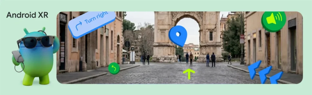
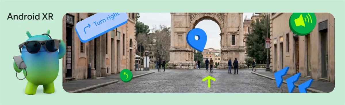
To demonstrate the transformative potential of this technology, Google’s internal teams unveiled the "XR Geospatial Tour"—a proof-of-concept application that reimagines urban exploration. Imagine donning a pair of lightweight, wired XR glasses—such as the forthcoming XREAL Project Aura—and being greeted by a context-aware, AI-driven tour guide that lives in your field of vision.
In this scenario, the traditional, cumbersome 2D map becomes a relic of the past. Instead, 3D waypoints float gently in the air, guiding the user through historical landmarks, while an intelligent voice narration provides real-time, curated historical context. This is not merely an overlay; it is an immersive, hands-free walking experience powered by a sophisticated stack of Google’s latest technologies: the Geospatial API, Gemini AI logic via Firebase, Google Maps Grounding, and the Jetpack XR SDK.
Chronology: Building the Future of Spatial Navigation
The development of the XR Geospatial Tour was a systematic exercise in merging high-precision sensor data with generative intelligence. The project team followed a four-phase implementation roadmap to ensure the experience was both accurate and intuitive.
Phase 1: Establishing the Anchor
The foundation of the experience is the ARCore Geospatial API. Unlike standard GPS, which can suffer from significant drift in dense urban canyons, VPS utilizes advanced computer vision to compare the device’s camera input against Google’s massive database of Street View imagery. This allows the system to derive a GeospatialPose—encompassing precise latitude, longitude, and orientation—that is vastly more reliable than satellite-based positioning alone. The development team implemented rigorous threshold monitoring, ensuring that horizontal and orientation accuracy meet specific requirements before triggering the tour, thereby preventing user frustration in suboptimal conditions.
Phase 2: Orchestrating the Itinerary
With the user’s exact coordinates established, the application queries the Gemini API. By utilizing Firebase AI Logic, the system prompts the model to act as a local expert. The team utilized gemini-3.5-flash to generate structured JSON itineraries, complete with tour titles, descriptions, and specific stops. To prevent the "hallucination" common in large language models—where AI might invent non-existent locations—the team leveraged Google Maps Grounding, ensuring that every recommendation is geographically verified and contextually relevant.
Phase 3: The Voice of the Experience
To foster a sense of presence, the team moved away from text-based instructions in favor of dynamic audio. By implementing the gemini-2.5-flash-tts model, the app natively returns audio data in response to prompts. This eliminates the latency and robotic cadence associated with traditional Text-to-Speech (TTS) engines, providing a natural, conversational guide that feels like a human companion walking alongside the user.
Phase 4: Spatial Rendering with Jetpack XR
The final stage involved rendering these data points into the user’s field of view. Using Jetpack Compose for XR, the team built "InfoSpheres"—interactive, floating 3D orbs that house information about points of interest. By utilizing SpatialBox and SceneCoreEntity, these elements were placed seamlessly into the physical environment, allowing users to interact with the tour via simple gestures or taps.
Supporting Data: The Technical Architecture
The technical elegance of the XR Geospatial Tour lies in its modularity. The integration of ResponseModality.AUDIO within the generation configuration allows the application to handle raw audio bytes directly, optimizing for speed and responsiveness in a real-time environment.
Furthermore, the use of InteractableComponent ensures that the 3D environment is not merely a passive display, but a responsive interface. When a user taps an InfoSphere, the application triggers an AnimatedSpatialVisibility transition, smoothly unfolding a 2D Compose UI panel that provides deeper context without obstructing the user’s view of the physical landmark. This blend of traditional 2D UI with immersive 3D entities is the cornerstone of modern Android XR development.
Official Perspectives and Industry Implications
The implications of this technology are profound. For developers, the barrier to entry for creating "world-scale" applications has been significantly lowered. "Building the XR Geospatial Tour showed us that the barrier to entry for world-scale spatial experiences is lower than ever," the Google team noted in their technical documentation. By abstracting the complexities of computer vision and AI grounding, Google is inviting a new wave of developers to populate the physical world with digital utility.
However, the technology remains in its nascent stages. The disclaimer provided by Google—that the demo is for demonstration purposes and that hardware remains in development—underscores that this is a vision of the near future rather than an off-the-shelf product today.
The Road Ahead: Developer Catalyst Program
To accelerate the adoption of these tools, Google has launched the Android XR Developer Catalyst Program. This initiative is designed to put the necessary hardware directly into the hands of those best positioned to innovate. By providing access to the XREAL Project Aura devkits and other display hardware, Google is fostering an ecosystem where the hardware and software evolve in tandem.
The integration of the Geospatial API into Jetpack XR represents more than just a new feature; it is an invitation to redefine human-computer interaction. As we move away from the "head-down" experience of mobile screens, we are moving toward a "head-up" future where information is seamlessly layered over our environment.
Conclusion: A New Frontier
The XR Geospatial Tour is a microcosm of the potential inherent in the convergence of AI and spatial computing. By combining the high-precision location data of VPS, the generative capabilities of Gemini, and the intuitive design patterns of Jetpack XR, developers can now create experiences that truly understand both where the user is and what they are looking at.
As the Android XR Developer Catalyst Program begins to distribute hardware, we can expect to see an explosion of creativity in the spatial computing space. From educational tools and historical tours to enterprise navigation and logistics, the ability to anchor digital content to specific, verified physical coordinates is set to become the standard for the next generation of computing. We are no longer simply looking at digital information; we are beginning to live within it.